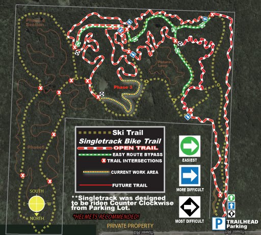
Singletrack is dry and fast and was cleared of all debris last night with blower. 2 of the 3 trees that were down have been cut out and one can be rode around right now. New Trail Signs have been put in place with Arrowed graphics. Also cut a Easier Spur Trail Entry to skip over The more difficult climbing section, (follow signs / see map above).
Planning on also re routing B-line option on Inside section as well.
Planning on also re routing B-line option on Inside section as well.
A bright surprise as you round a corner before log pile.
New fungi growth on tree along trail, BRIGHT Orange very cool.
New fungi growth on tree along trail, BRIGHT Orange very cool.
New Signage in place
(Thanks to BrushMARKS for printing the reflective decals and Becker County Hwy Dept for the sign posts.)


